Spring Field Trip - Petrologic and Structural Evidence for Flat Subduction Tectonics in Santa Catalina Mountains
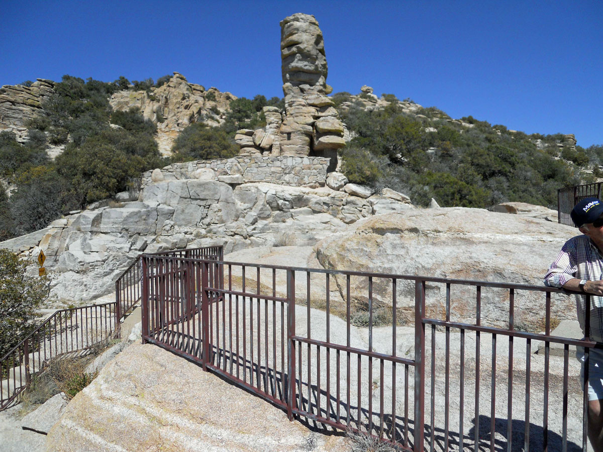
Windy Point looking SSE toward Santa Rita Mountains with an outcrop of Wilderness Granite in foreground.
Field Trip Leader: Stan Keith, MagmaChem and Jan Rasmussen, Consultant
Field Trip Description - AGS Members and their guests are invited to participate in the AGS 2019 Spring Field Trip to Mount Lemmon along the Catalina Highway.
Tour Date/Time - Saturday. June 8, 2019, 7:00 AM. The official trip will end at 3:00 PM. You are welcome to stay longer to enjoy the cool mountain air and stay for the weekend. Accommodations are limited to camping and perhaps a few air-b-n-b rentals, and good eating and drinks at the Iron Door restaurant at the ski lift.
Carpooling - For safety reasons, Carpooling is strongly encouraged (4 passengers per vehicle if possible), since parking space along the Highway is limited. Attendees should meet at the gas station/parking lot, located on the northeast corner of Tanque Verde and Mount Lemmon Highway at 7:00 AM.
Registration Fees - Members - $35, Non-member -$40, Students - $15
Registation Fees include a Field Trip Gruide Book, lunch, beverages and snacks.
Meals -
We will provide sandwiches and soft drinks and water. There will be a lunch stop at the famous garnet schleiren locality south of Summerhaven.
Level of Difficulty - The level of difficulty for the trip is normal. Temperatures are expected to be in pleasant warm ranging from 70 to 85 degrees F.. Elevation is 3,600 to 8,000 feet). Sunscreen lotion and a good hat to protect the head from too much UV are strongly recommended. Eye protection is required, to protect yourself not only from your own hammering away on rocks, but also to shield you from rock chips flying of the adjacent geologist's pick. Hand protection is also encouraged (work gloves).
Field Trip Stops - All of the stops will be essentially road cuts or places where people only have to walk 50 yards on easy trails.
White Biotite Eocene Wilderness Granite (~55 Ma) intruding darker Precambrian Oracle Granite (~1440 Ma) exhibiting synkinematic deformation at Babad Do'ag Overlook
Stop 1: Babad Do’ag overlook at picnic area at base of mountain to examine the light-colored, biotite granite phase of the lower part of the Wilderness two-mica (biotite-muscovite) granite sill complex (now well dated at 55 Ma) that intrudes into the dark-colored, sheared Proterozoic Oracle Granite (1440 Ma). We will also discuss the influence of hydrous magmato-hydrothermal effects on the peraluminous sills as shown on zircons.
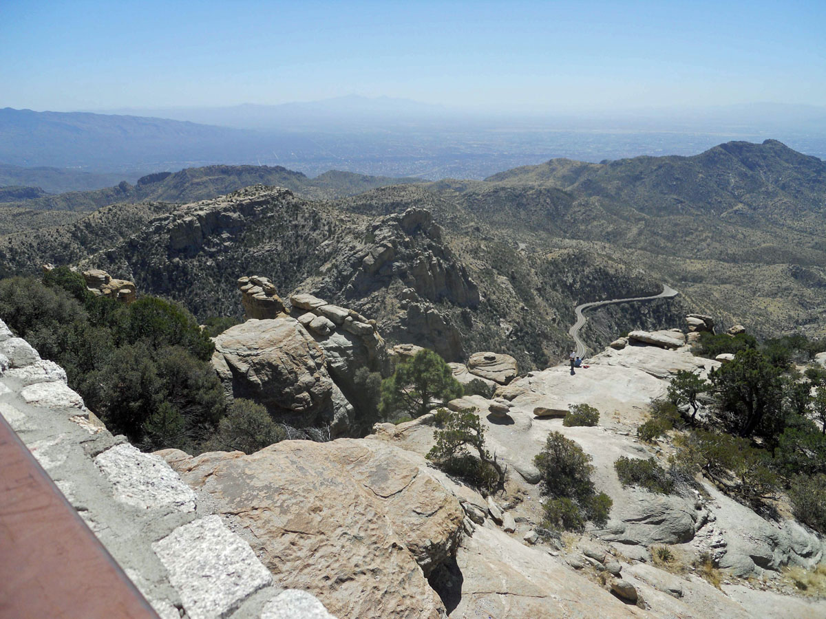
Windy Point looking East with outcrop of Wilderness Granite in foreground.
Stop 2: Windy Point to examine the two-mica granite in the main range Wilderness sill to examine “fish flash” showing the southwest-directed tectonic flow in the Windy Point shear zone. The zircon characteristics differ between the main range two mica granite sill (melt products of 1440 Ma crust) and the fore range biotite granite sills (older xenocrystic zircons that are in part melt products of older crust).
Stop 3: Bear Wallow to see folded Apache Group and southwest-directed thrust tectonics in the Bear Wallow thrust. The co-eval relationship between the two-mica granite emplacement (45-48 Ma) and the Bear Wallow thrust will be discussed.
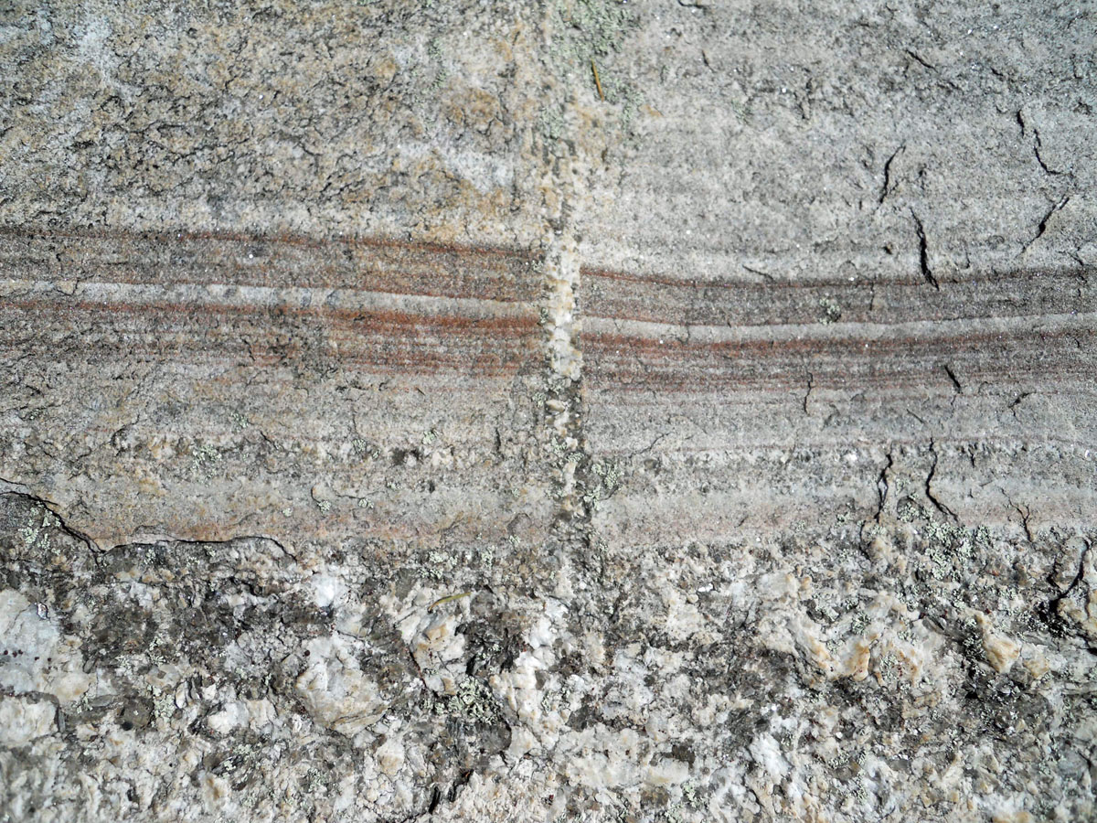
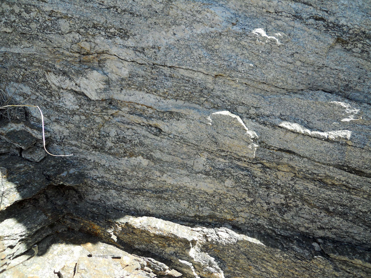
Spessartine Garnet Schleiren cross cut by a small pegmatite dike at Marshall Gulch south of Summerhaven.
Stop 4: Garnet schleiren south of Summerhaven to see garnet bands in the Lemmon Rock Leucogranite, the youngest sill (up to 40 Ma) in the Wilderness granite sill complex, indicating left slip in an east-west shear zone that occurred during the emplacement of the multi-phased aplo-pegmatite dike. The garnet geobarometry indicates emplacement at depths of 13-18 km and the displacements indicate a NE-SW compressive tectonic regime.
Petrologic and Tectonic Significance of the Wilderness Plutonic Suite: Products from a Massive Water Flood Event of Hydrous Crustal Melting Event During High-Speed Flat Subduction in the Latest Laramide by Stan Keith and Jan Rasmussen
Abstract: The main goal of the field trip is to demonstrate with field evidence the petrologic and tectonic connection of Wilderness suite peraluminous magmatism to flat subduction toward the northeast beneath the North American plate in the Eocene. The petrology of the peraluminous two-mica magmatism is linked to massive hydrous melting of Proterozoic to Mesozoic basement by water flood events resulting from dehydration of the flatly subducting slab. The peraluminous magmatism fractionated W-Be metallogeny that was inherited from pre-existing peraluminous crustal sources, such as the 1400-1450 Ma Oracle Granite. This observation precludes explaining the origin of the porphyry copper deposits by leaching from pre-existing rocks. The source for porphyry copper deposits is better explained by their associated metaluminous calc-alkalic magmatism from mafic sources in the layered upper mantle. The scale and volume of the peraluminous magmatism throughout Arizona dwarfs that of the porphyry copper event. A consistent SW-directed mylonitic fabric is present in many of the peraluminous sills and fits with a SW-directed thrust and the anvil shape of the intrusive sill complex.
The entire suite of peraluminous magmatism occurs in the lower plate of a regional SW-directed thrust system that we previously named the Maricopa Thrust system (Keith and Wilt, 1986), which we suggested may have over 100 km of southwest-directed transport. In the context of Laramide flat subduction tectonics, we now interpret the Maricopa thrust as an intraplate subduction zone linked to the flatly subducted Orocopia Schist. The presence of Orocopia Schist has recently been mapped in the Plomosa Mountains (Strickland and others, 2017) and oceanic ultramafic harzburgite rocks were identified by Haxel and Jacobson (2013) at Cemetery Ridge. A regional plate of deformed mylonitic rocks that dips northeastward under the Colorado Plateau was documented in a seismic section in Reif and Robinson (1983). These new data and interpretations of older data emphasize the importance of flat subduction as the principle Cretaceous-Cenozoic tectonic episode. The field data (such as SW-directed mylonitization) is now more properly ascribed to the trench-directed tectonics induced by flat subduction.
The Santa Catalina mylonites and their well-developed associated peraluminous magmatism provide one of the best field examples of flat subduction tectonics as it impacts the mid-crust. Hence, the main Cretaceous-Cenozoic event in Arizona and the rest of southwestern North America has more to do with compression, flat subduction, and associated deep, mid-crustal level, peraluminous magmatism than mid-Cenozoic crustal extension, which was a denudation effect of relative uplift of the mountain. In this regard, the term 'Metamorphic Core Complex' is a misnomer. This reconsideration of Catalina field geology may lead the way to a massive rethink of Cordilleran geology in the context of compressive flat subduction at the end of the Laramide orogeny and points to future research possibilities.
Contact Info - If you have additional questions about the Spring Field Trip contact Stan Keith at (520) 668-4890 or
mcheme@aol.com.